
News
All project activity
All project activity
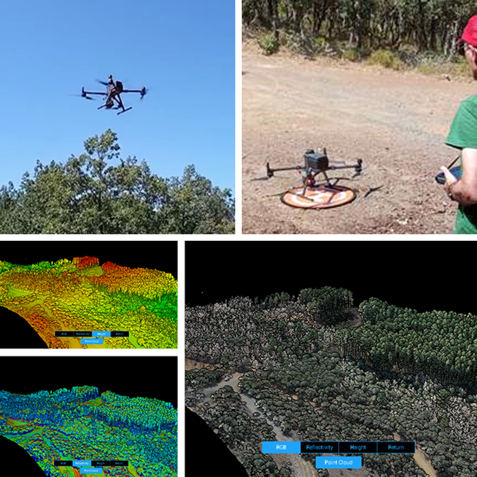
The LIFE SILFORE project has carried out the first observations using UAVs (unmanned aerial vehicles) in the two study areas. The aim of these surveys is to obtain a detailed reconnaissance of the composition and structure of these two particular forest plots.
The two study areas are located in Zeive (Paramio, Bragança), where the Pyrenean oak (Quercus pyrenaica) forest formation can be found, and in Vilarinho (Bragança), where the holm oak (Quercus rotundifolia) forest formation is present. Both forests are protected by the Habitats Directive.
To carry out the studies, the project team used LIDAR sensors, which is a laser remote sensing technology that allows detailed mapping and analysis of land surface topography and vegetation in 3D. In addition, the MicaSense multispectral sensor, which provides information on the spectral properties of vegetation in different bands of the electromagnetic spectrum, was also used.
The team responsible for the operation of the UAV and data analysis is composed of João Paulo Castro, responsible operator; Marina Castro, project coordinator; José Castro, Vitor Siripieri and Filipe Pacheco, who together guarantee the success of the action and the analysis of the data collected.
The first results obtained from these flights will still be released in due course. These results are expected to provide valuable information on the composition, structure and condition of the studied forests before their pastoral use, contributing to the preservation and proper management of these protected areas.